
Senapati
Manipur, India
Why visit Senapati?
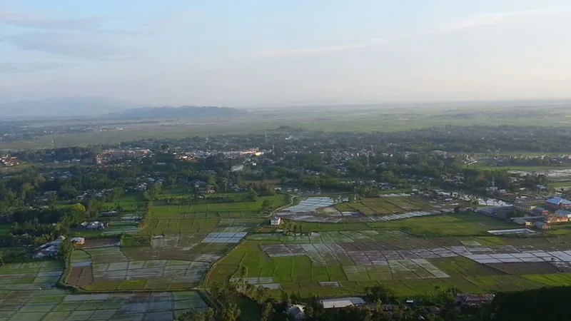
Senapati is a hill town in northern Manipur and the headquarters of Senapati district, strung along the main highway between the Imphal valley and Nagaland about 60 km north of the state capital. It sits in country dominated by Naga communities — Mao, Poumai, Maram, Thangal and Zeliangrong peoples — who are largely Christian, and it serves as the administrative and market centre for a wide spread of hill villages. For travellers, Senapati is most useful as a staging point on the Imphal–Kohima–Dimapur road and as a gateway to the high Naga uplands of the far north of Manipur.
The town's character is hill-Naga rather than valley-Meitei: terraced fields on the slopes, churches in the villages, distinct tribal languages, dress and festivals, and a cooler, breezier feel than the plains. The surrounding district holds some of Manipur's most dramatic high country, including the state's tallest peaks and, near the Nagaland border, the celebrated Dzükou valley, making the area attractive to trekkers and lovers of mountain scenery.
Lying at greater elevation than Imphal, Senapati has a pleasant, temperate-leaning climate: cool and clear in the dry months of roughly October to March, and wet during the southwest monsoon from about June to September, when hill roads can be affected by rain and landslides. The post-monsoon and winter months are the most comfortable for travel and trekking.
Planning Senapati? Tell us your dates and we’ll tailor the trip.
Ask on WhatsAppHow do you get there?
By Plane
The nearest airport is Imphal International Airport (Bir Tikendrajit International Airport, IATA: IMF), about 60–70 km south of Senapati, with flights to Delhi, Kolkata, Guwahati and other Indian cities. From Imphal, continue north to Senapati by shared taxi or hired car along the highway; there is no airport in the town.
By Car / Road
Senapati lies directly on National Highway 2 (the old NH-39), the main Imphal–Kohima–Dimapur route, which makes it easy to reach by road: roughly 60 km (about 1.5–2 hours) north of Imphal and on the way to Kohima in Nagaland. Shared Tata Sumo vehicles and buses running between Imphal and Dimapur/Kohima stop at Senapati through the day. Carry identity documents for highway checkpoints, and check road and security conditions before travelling.
The town itself is small and walkable, spread along and just off the highway. Local shared taxis and autorickshaws handle short hops, while reaching outlying villages, viewpoints and trekking trailheads generally means hiring a vehicle or using shared transport; agree the fare beforehand, as there are no meters.
What are the things to do?
- High Naga uplands and viewpoints — the ridges and terraced hillsides around Senapati offer sweeping mountain scenery, and the district contains Manipur's highest peaks.
- Mao and Makhel (northward toward the Nagaland border) — the Mao Naga area, with Makhel held sacred in Naga oral tradition as an ancestral dispersal site, lies north of Senapati along the highway.
The big draw of the wider Senapati region is mountain trekking and scenery: the district borders the famous Dzükou valley on the Manipur–Nagaland frontier, reached on foot from the Mao side, and holds high peaks that attract walkers. Beyond trekking, visitors come to experience Naga hill-village culture and to time a trip to coincide with community and harvest festivals, when villages celebrate with traditional dress, dance and feasting.
Planning Senapati? Want these on a customised itinerary?
Ask on WhatsAppWhere to eat?
Food here is Naga hill cuisine: rice with boiled and smoked meats, leafy greens, bamboo shoot, fermented preparations and fiery local chillies, simply prepared and quite different from valley Meitei cooking. Roadside eateries and tea shops along the highway serve hill-style meals and standard Indian fare to travellers.
Where to drink?
Tea is the staple drink, served at the town's tea shops and highway stalls, alongside local non-alcoholic preparations. Tap water is not reliably safe — use bottled or boiled/filtered water.
Planning Senapati? We’ll book the stays and dining for you.
Ask on WhatsAppWhere to stay?
Senapati has simple lodges and guesthouses geared to highway travellers and district visitors rather than tourists.
What should you buy?
Senapati's market supplies the surrounding hill villages and is a place to find Naga handloom textiles — woven shawls and wraps in distinctive tribal patterns — along with local farm produce and everyday goods. Bargaining is normal at market stalls.
Where to go next?
- Imphal (about 60 km south, ~1.5–2 hours) — Manipur's capital, with Kangla Fort, Ima Keithel and Loktak Lake.
- Mao / Makhel (north toward the Nagaland border) — Mao Naga country and the trailheads on the Manipur side toward the Dzükou valley.
- Kohima, Nagaland (north along NH-2) — the Nagaland capital, with its WWII war cemetery and access to Dzükou from the Viswema side.
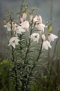
- Dzükou Valley (Manipur–Nagaland border) — the renowned seasonal-flower valley, a multi-hour trek best attempted with a guide.
Nearby in Manipur
More places to explore around Senapati.
Guide content as of June 2026.

Contact Us
Get in touch with us.
Get in touch
Contact Us
Tell us where you'd like to go and how you like to travel. A real Tripcuro planner — not a bot — will craft an itinerary around you.
- Personalised, hassle-free planning end-to-end
- Transparent pricing, no hidden costs
- 24/7 support for complete peace of mind